Introduction to Azure Maps: Build location-based applications in Azure

Azure Location Based Services (LBS) has been rebranded as Azure Maps and is now publicly available. Azure maps comprise of simple and secure location APIs that provide geospatial context to data. The solution quickly lets users build and deploy location-based applications in the Microsoft Azure cloud platform.
In this post, briefly looked at Azure Maps as a platform, the functionalities it offers, and the cost of deploying your maps and services on the Azure platform.
1. What is Azure Maps?
Azure Maps is a portfolio of geospatial APIs & web services that can be used for spatial analysis and visualization.
Azure Maps is designed to allow seamless integration of mapping, search, routing, traffic, and time zone queries into all levels of location-based apps.
2. Features & Services of Azure Maps.
The Azure Maps is a developer toolkit that includes a set of features and services for mapping, search, geocoding, routing, traffic, and even time zones.
A. Render Service:
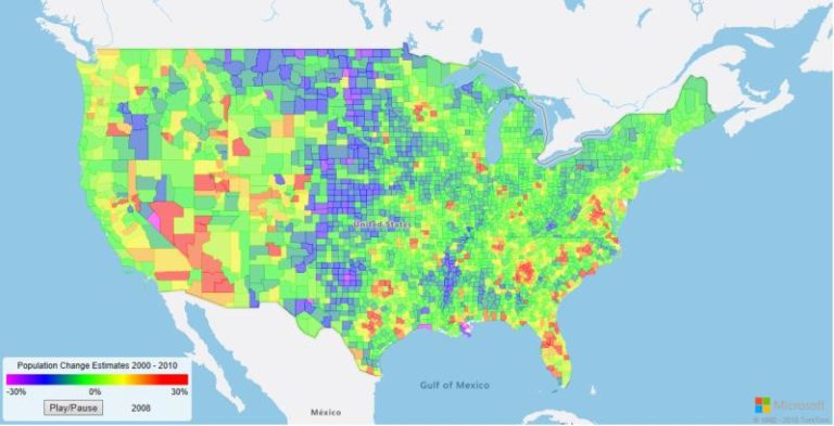
Integrate clear, easy-to-read maps into your solutions with the Render API. The Render service is designed for developers to create web and mobile applications around mapping. The service uses either high-quality raster graphics images, available in 19 zoom levels or fully customizable vector format map images. The Render service also offers preview APIs that allow developers to work with satellite imagery.
B. Search Service:
The Azure Maps Search service is designed to search for addresses, places of interests and business listings by name or category, and other geographic information such as latitudes and longitudes. The search service is packed with three major functions: Geocoding, Reverse Geocoding, and Point of Interest (POI) search.
C. Routing Service:
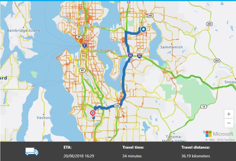
The Azure Maps is also packed with routing service that can help calculate the best and shortest route from “Point A” to “Point B” while accounting for types of transportation, traffic conditions, and route restrictions. The service allows developers to calculate directions across a number of travel modes such as car, truck, bicycle, or walking.
D. Traffic Service:
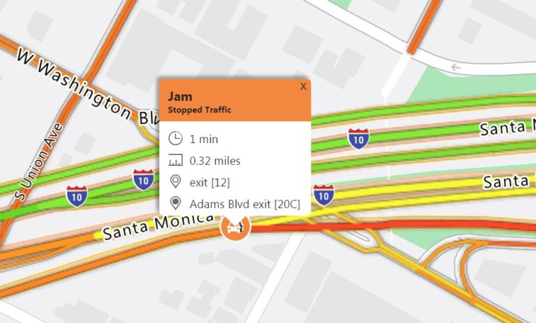
Azure Maps Traffic service gives users the ability to create location-based applications that require traffic flow information in close to real-time. Azure Maps live traffic information is updated every two minutes. The traffic service provides two data types:
Traffic flow: real-time observed speeds and travel times for all key roads in the network.
Traffic incidents: an accurate view of the traffic jams and incidents around the road network.
E. Time Zone Service:
The Azure Time Zone Service provides localized time zone information in about 50 languages for places around the world. See what time it is anywhere in the world. Select a location to find the time zone, its offset to Coordinated Universal Time (UTC), and daylight saving time updates.
3. Pricing & Cost of set-up.
It’s free to get started with Azure Maps. The Standard S0 free tier comes with 250,000 transactions for Maps and Traffic Tiles and 25,000 transactions for Other Maps Services are included for free per month.
The Azure Maps standard pricing comes in two tiers:
Standard S0: For small-scale deployments, customers requiring only the core geospatial APIs, and/or customers with small volumes of concurrent users. Additional cost for this tier after you’ve exhausted the free limit is $0.50 per 1,000 transactions.
Standard S1: For customers who need support for large-scale enterprise, mission-critical applications, have high volumes of concurrent users, and/or require advanced geospatial services. The pricing for this tier is $5 per 1,000 transactions.
You can manage the pricing tier of your Azure Maps account through the Azure portal. Once you create an account, you can view or change your account’s pricing tier.
Comments
Join the discussionNo comments yet. Be the first to comment.